Eurogeo 1.2.0 – find countries on our interactive map of Europe
Knowing a country's flag or capital is one thing. Knowing where that country actually is on the map turns out to be another, and it is the part a quiz made of cards cannot really ask about.
In version 1.2.0, the map of Europe joins Eurogeo on both sides of the question. It can be what you are asked about – a country picked out on the map, and you name it or choose its flag. And it can be what you answer in: you are given a name or a flag, and you have to tap the country on the map. In those two new games, a tap picks, a button confirms, and you can navigate the map with the usual pan and zoom gestures.
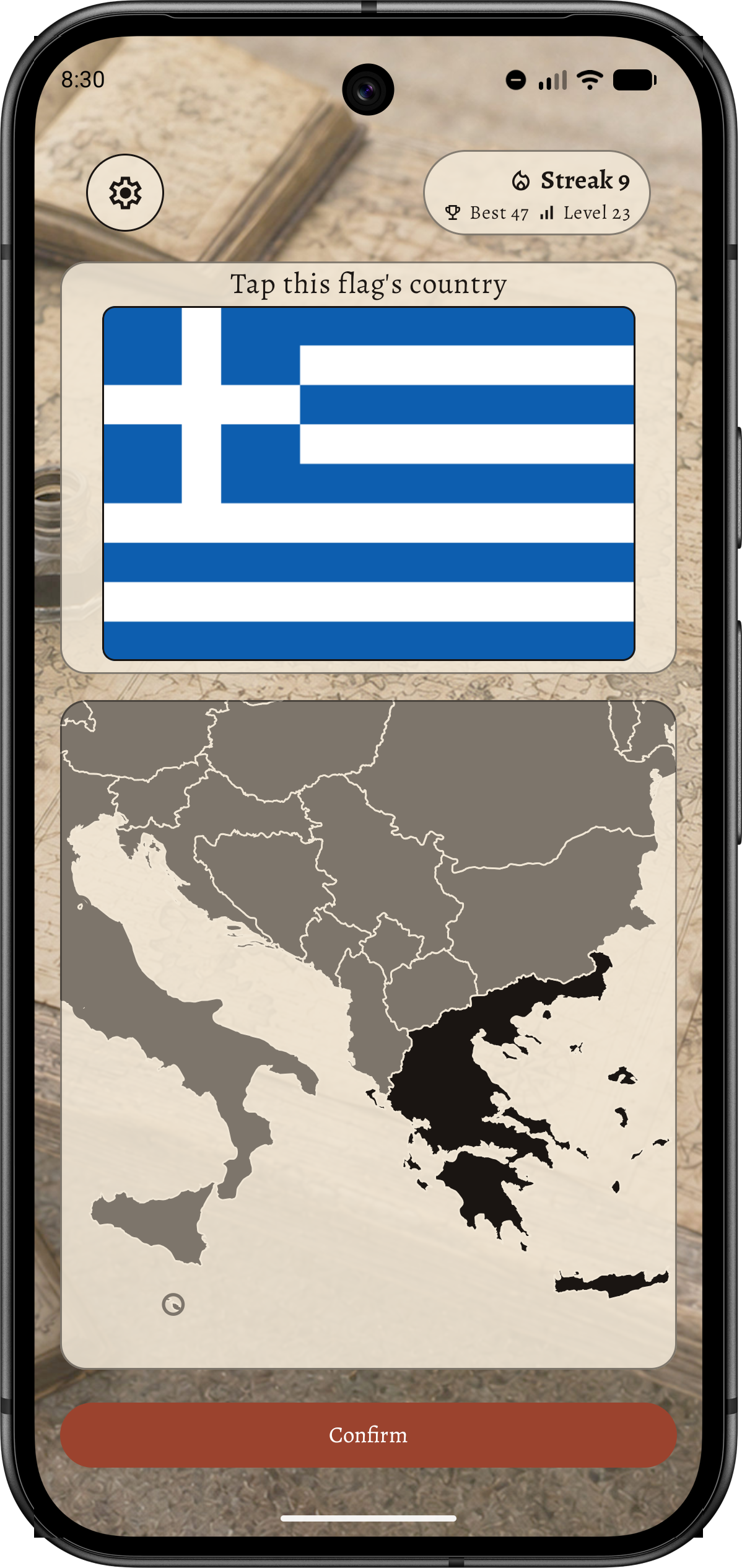
One map, drawn once
Every country is drawn in one shared coordinate frame, so the map is the same whichever game is using it. The contrast of the country picked out is measured against the countries around it. Those receded countries are in turn measured against the background colour.
Microstates are the interesting case. Vatican City is a few pixels wide at the default zoom, so a ringed country gets a minimum target a finger can actually hit, and you can pinch to zoom and drag to pan when you want to be precise.
Reaching the map without sight
For screen readers the map is an adjustable control: you step country by country and hear where you have landed, with zoom offered as explicit actions rather than as a gesture nobody can discover.
Also in this release
The question picture now grows with your chosen text size instead of shrinking while everything around it grows. Under the hood, the map's geometry is built once for the whole app rather than once per screen, and a leak that retained a screen on every rotation is fixed.
Comments
No comment yet.
A remark, a suggestion? Do not hesitate to express yourself below. Just be courteous and polite, please.